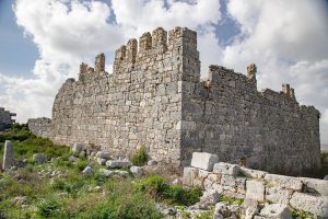
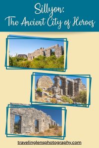
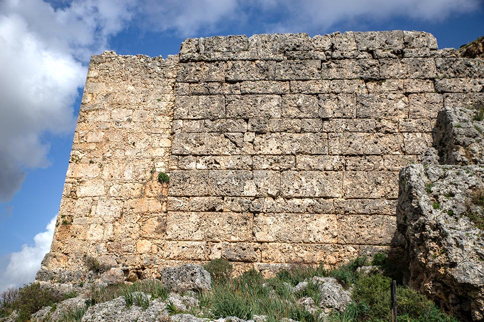
Located high up on a hill outside of Antalya city center is Sillyon, one of Pamphylia cities. It was considered one of the wealthiest cities of ancient times, thought to be discovered by heroes of the Trojan War. Once covering the hill and its surroundings, the ancient elaborate city has fallen into rubble and was buried due to a landslide in 1969. The city preserved remains to sit upon the hill, approximately 210 meters above the Aksu River, still seeing the fortification outline that Alexander the Great could not conquer.
ENTRANCE
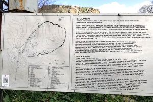
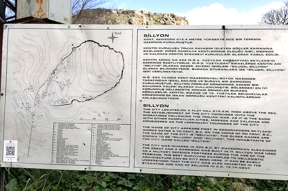
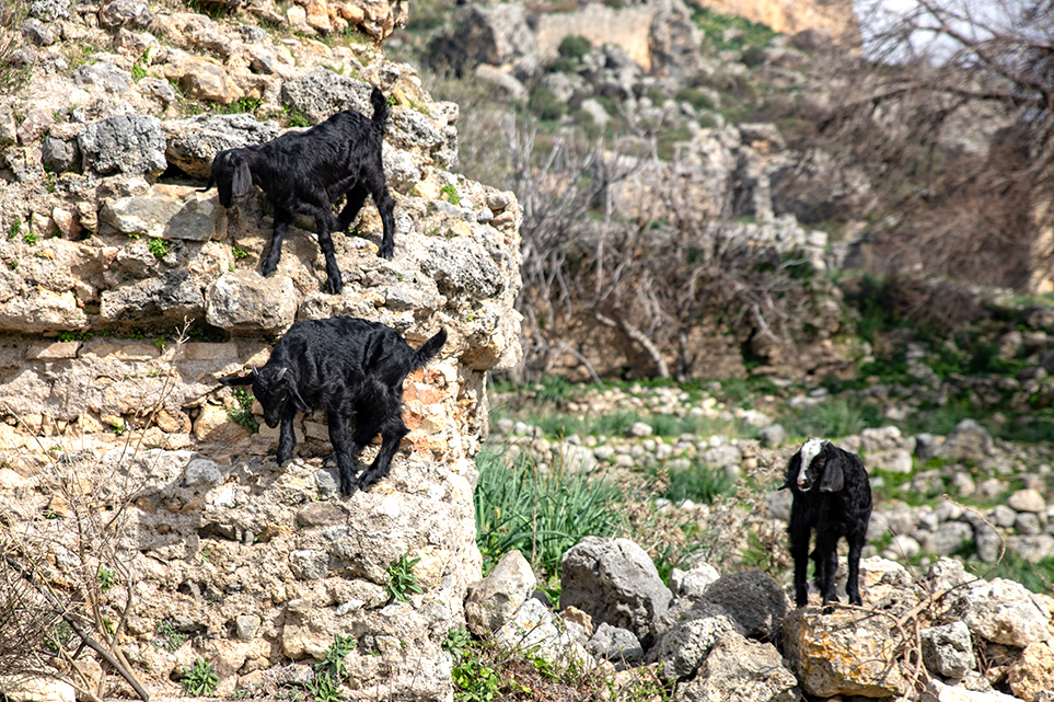
Upon arrival, you will see a large sign explaining the layout of the ancient city. It is free to explore, and very little information available on site, so do your homework. A small café is located across the street during the high season, serving a few Turkish dishes and drinks. We saw a few people scaling up the hill, so we decided to follow them in their traveling direction. As we made our way up the hill, we came upon three young goats playing along the fortress walls enjoying the cool breeze and fresh grass.
LOWER LEVEL
Once you enter through the (B) Lower Fortress Walls, you begin to see remains of ancient ruins lying about on the ground. Beyond the walls, on your right you will see (V) Ancient Water source located near the Roman Baths with fresh spring water still running like a faucet. To the right are the remains of a (P) Ancient Palace. If you continue to the right, you will not find any other structures other than the few you can see upon the hill. The trail seems to be from where goats travel around the hill.
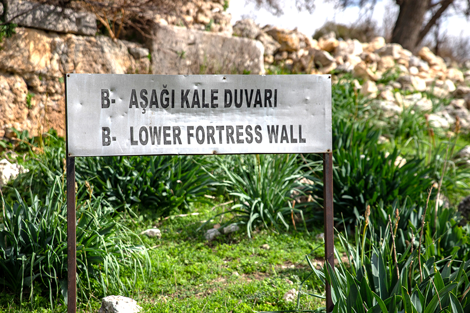
Lower Fortress Wall
Watch Tower
The Palace
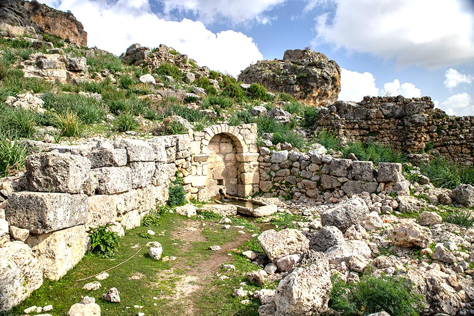
Water Source
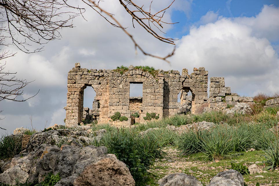
WEST HILLSIDE
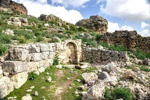
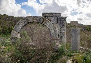
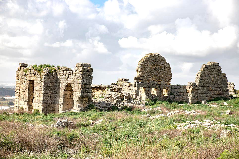
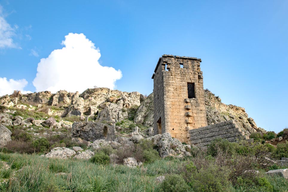
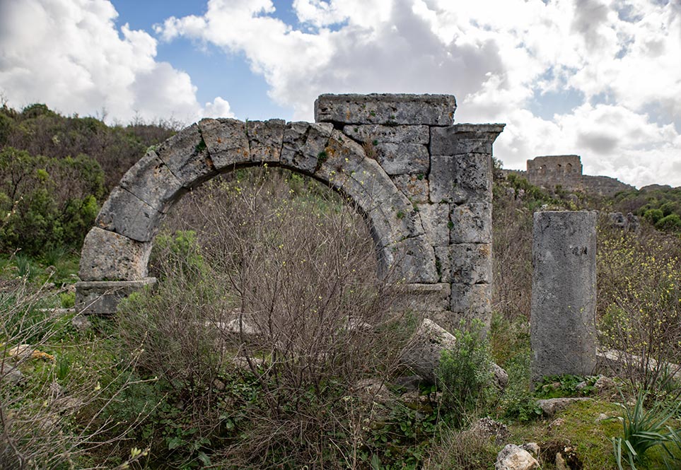
Continuing walking west (left) and up the hill, you will come upon the (D) Watch Tower. There are several along the way, but some have fallen since the landslide. You will then enter the Hellenistic Walls. Next, you will see the Bastion (D2) that looks like a huge corner wall. The arch windows and remaining arch walls are from the Roman Baths. The climb starts to become challenging after this point, so watch your step.
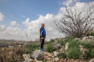
Climbing the Hill
Bastion
CHALLENGING CLIMB
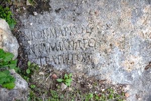
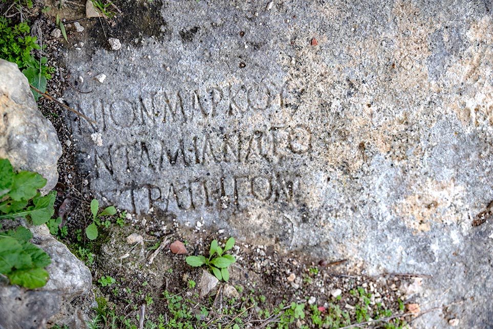
As the climb became more challenging, I had to struggle to find safe places to step. As I climbed a wall, I came upon a few stones with Greek writing and balanced on the rocks to snap a few pictures. The climb in some areas is so challenging that I don’t recommend risking injuring yourself to get to the top, so be careful! My husband ended up dropping our camera stick and was unable to retrieve it.
As we reached another level, we came upon what looked like a (d) mosque or, possibly, an ancient house. A fence surrounded the ruins to protect them from vandals. Near the mosque is the (O) Stoa, a covered walkway, usually surrounding the outside of a building. You will also discover large cisterns, and because they are not well marked, be careful as they are scattered about and not marked.

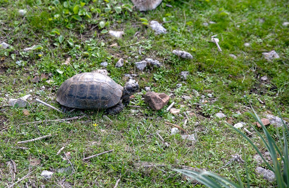
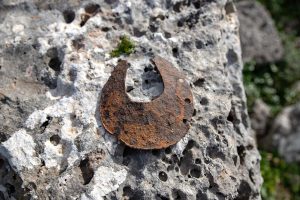
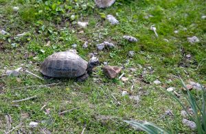
As we continued our hike up the hill, we came upon an old rusty horseshoe. Not sure how old the horseshoe is, but I thought it was an exciting find. We also ran into a healthy green turtle, out grazing. He kept a close eye on us as we stood nearby him to examine him.
THE PEAK
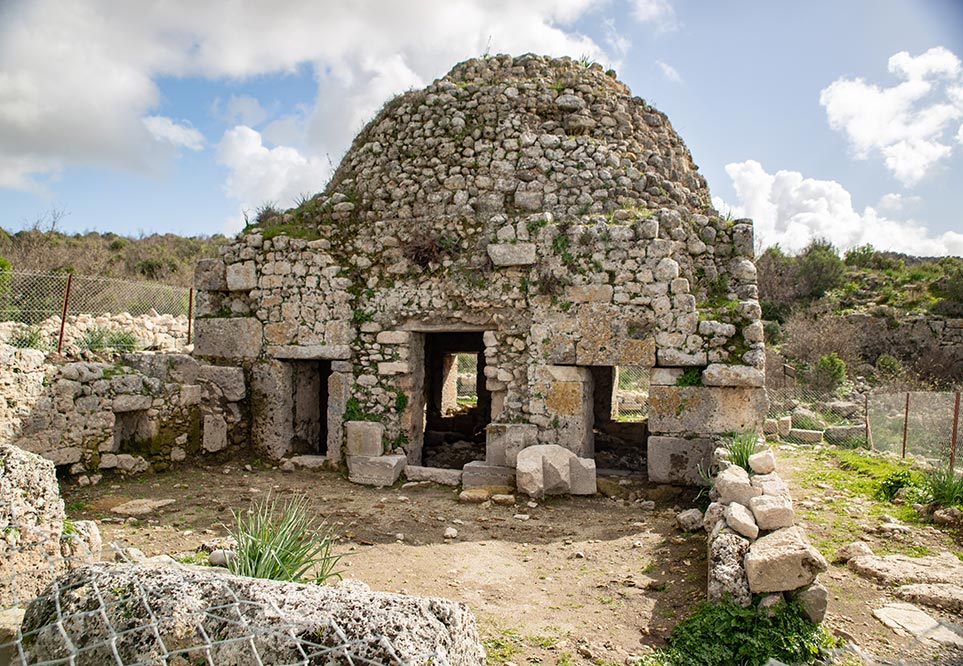
On top of the hill is the (b) Byzantine Ancient Building with vaults. You may find Greek writing on several stones as you walk around the building. It seems as if this building had an arched roof which is unique to see in this area. Across the way, you will see (G) Hellenistic Building. From here, you can see the remains of ancient ruins below. On the far west side of the hill is parts of the old theatre. We did not walk to that area.
More ruins lie around the hillside, such as the stadium, tombs, and small churches, but we did not have time to check them out. We saw a shepherd herding his sheep across the hill. Local villagers live in the area and use the land to graze their animals.
Byzantine Ancient Building

Hellenistic Building
History
The first recording of Sillyon was during the 5th century BC for taxes. For many years, the city disappeared from records and did not appear until 333 BC, when Alexander of Macedon’s army successfully repelled because of its imposing fortifications and an army of mercenaries.
The Seleucid dynasty took power over Sillyon during the Hellenistic period and expanded it with many new structures such as the theater. Here, it was able to mint its coins until the 3rd century AD.
During the Byzantine era, Sillyon played a critical role in history as it was the birthplace of Constantine II and Anthony I. Due to conquering the Arabs in 678 AD, the city became home to the imperial representatives and connecting point between the Mediterranean Sea ports to Iznik to Constantinople. During the 8th and 9th centuries, Sillyon became a significant city in the region, overshadowing Perge.
Despite the fortifications, the city and the entire region of Pamphylia were conquered by the Seljuks in 1207.
Visitor tips:
Admission to Sillyon ruins is free of charge. If you visit during the off-season, you may not find a tour guide and will have to explore on your own. I encourage you to go with a tour guide, if possible, to learn its complete history.
Understand that there is limited signage marking a few of the areas. You will need to wear good walking/hiking shoes for the site is rocky terrain. Keep your eyes open for the loose rocks.
The visit will take 1.5 – 2.5 hours to explore. Depending on your ability to hike/climb up a hill and how much of the area you feel like you want to see will depend on the length of time. We spent two hours and still did not see everything.
Make sure to take with you bottled water. The climate is dry, and you will get thirsty as you continue up the hillside. If you wish, bring along a few snacks to enjoy while enjoying the view from the top.
Limited shade, so brings a hat for covering and wear plenty of sunscreen. Also, no lights, so if you go too late in the evening, you will need a flashlight to see where you are walking.
Getting there:
By car: If you are coming from Antalya, take D400 road in Manavgat and Alanya’s direction. After 20 kilometers, take a side road to the north, in which you will see a brown sign stating Sillyon. The distance from this junction to Sillyon is 11 km. The road leads first to the north, through Abdurrahmanlar village, and then to the east, to Asar Köy village. The hill with the ruins of Sillyon is visible from the access road. Once you arrive, a small gravel parking area, though no amenities (no restrooms). You will see many greenhouses along the way.
Enjoy your travels! Please read my blog about other exciting places around the world at Traveling Lens Photography.
If you want to read more follow me on Facebook, Instagram, or Pinterest as I share my journey.
Inshallah! ( God willing)